Clima en Parque nacional volcánico Lassen en agosto
Parque nacional volcánico Lassen en agosto: agradable, seco — un momento excelente para ir.
Actualizado: septiembre de 2026 · normales climáticas del reanálisis ERA5
n.º 3 de 12 meses en Parque nacional volcánico Lassen · n.º 292 de 1413 destinos para visitar en agosto · confort 89/100 (nivel A)
- Días
- 25°C
- Noches
- 12°C
- Días de lluvia
- 4
- Sol
- 12.5 h
- Humedad
- 40%
- Horas de luz
- 14 h
Notas de viajeros sobre Parque nacional volcánico Lassen en agosto
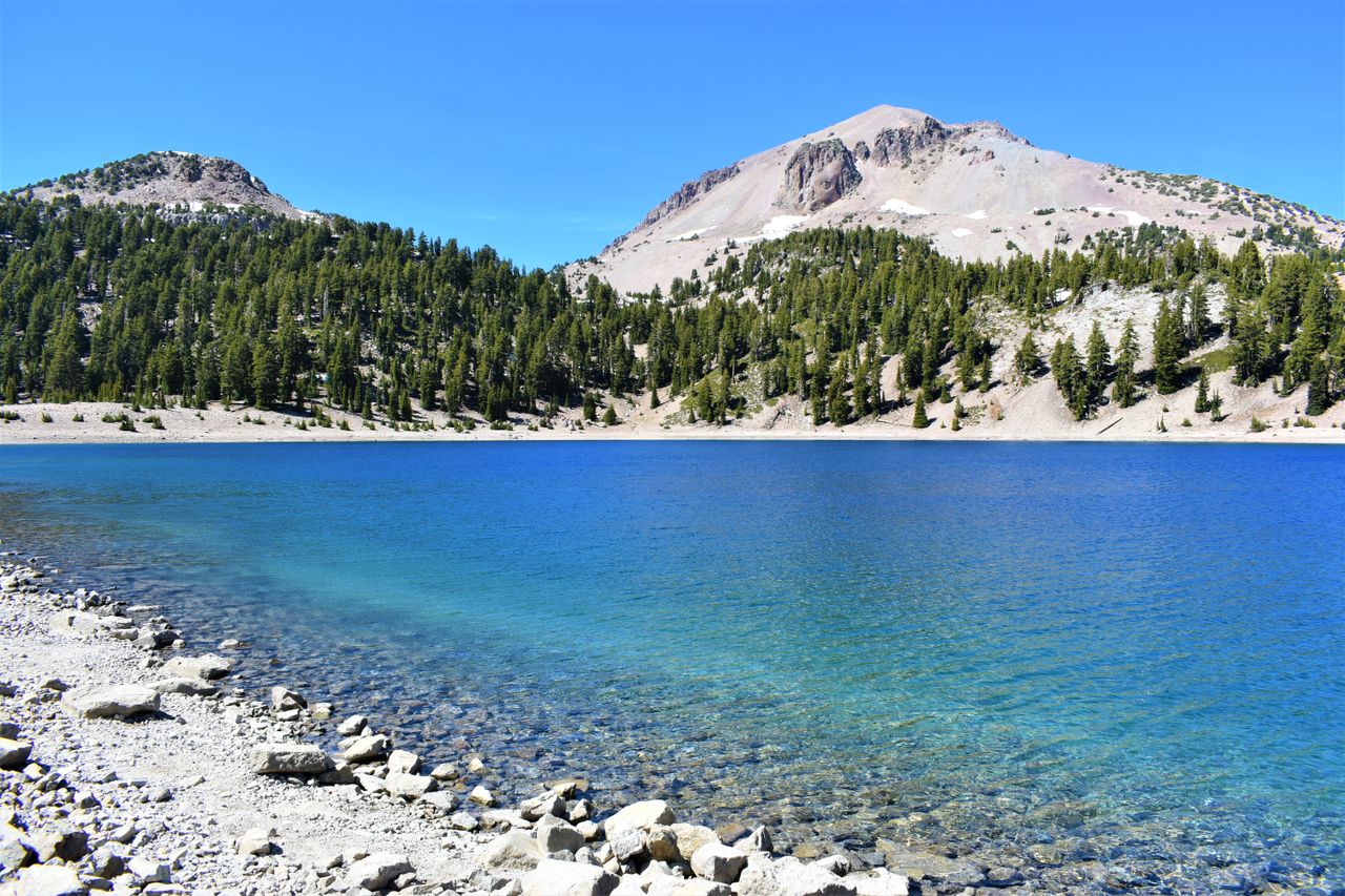
Lassen Volcanic-forum threads on August visits call it one of the best months of the year here, comfortable daytime temperatures at the park's high elevation even as the surrounding valleys run noticeably warmer, and posters describe conditions as almost spring-like on the higher trails, wildflowers still out well into the month. The main park road summits around 8,500 feet, and lingering patches from the past winter can still be visible in shaded pockets even in August some years. Regulars flag wildfire smoke as the real wildcard for this stretch of summer, capable of dulling views and air quality with little warning depending on fire activity elsewhere in the region. Bumpass Hell's boardwalk trail through the geothermal features is repeatedly named the highlight activity for this time of year. The record: 24.9C days feeling like 23C, 11.5C nights, a low 40 percent humidity and 12.5 hours of sun.
Otros meses en Parque nacional volcánico Lassen
Lassen Volcanic-forum threads on a January visit describe Highway 89 as genuinely closed for winter, posters naming a closure that typically starts in October or November and sometimes doesn't lift until June or July. Regulars call the Loomis area and Kohm Yah-mah-nee Visitor Center genuinely still accessible near the southwest entrance, several posters naming this the real way to experience the park despite the main road being shut. Posters call ranger-led snowshoe walks a real winter activity, several regulars naming Saturdays from early January through early April as when these run. Regulars call one January notably unusual, several threads recalling a year the road stayed open with snow piled high alongside it, an exception rather than the rule. Posters recommend checking current road status, several regulars calling this standard given how much winter access varies. The record: 1.4C days, -5.8C nights, an extraordinarily high 200.9mm across over 14 days and 81 percent humidity.
Lassen Volcanic-forum threads on a mid-July visit describe daytime conditions as comfortable, posters citing highs around eighty-four degrees Fahrenheit at Manzanita Lake with real chill setting in overnight regardless of how warm the day felt. Regulars call July, August and September the strongest overall window, the park highway itself typically clear by mid-July even when a few higher trails aren't fully open yet. Posters recommend checking Bumpass Hell trail status specifically, the park often aiming to open it by July depending on how much cover the winter left behind. Regulars call crowds genuinely light even during a busy stretch, full parking lots still feeling far less packed than other national parks. Posters recommend Brokeoff Mountain, Lassen Peak, Kings Creek Meadows and easy strolls around Manzanita and Reflection Lakes as solid July picks. The record: 26C days feeling like 27C, 12.1C nights, 7.6mm across nearly 3 days and 26 percent humidity.
Lassen-forum threads on a May visit describe real snow as still a standing feature, one visitor reporting having to hike across snowfields to reach the summit even at the end of the month. Regulars call the main park road still buried through most of May in a typical year, driving through to see the geothermal features simply not possible yet. Posters describe access as limited to the Kohm Yah-mah-nee Visitor Center from the southwest entrance and Loomis Plaza or Manzanita Lake from the northwest, both partial options. Regulars call clearing generally starting in April, full opening rarely happening before June and sometimes running into July depending on the snowpack. Posters recommend checking current road status before planning a May trip, conditions varying considerably year to year. Regulars recommend real cold-weather and snow gear regardless of how mild the valley feels. The record: 13C days feeling like 11C, 1.7C nights, 66.8mm across nearly 9 days and 60 percent humidity.
Lassen Volcanic-forum threads on late-October visits describe this as genuinely beautiful but capable of turning cold fast overnight, daytime readings still reasonably comfortable into the sixties Fahrenheit while nighttime lows commonly drop below freezing. Posters call the park's microclimate a real factor, conditions here often feeling noticeably harsher than the raw temperature suggests. Regulars describe most campgrounds as closing between mid-September and early October, Manzanita Lake generally the one exception staying open until an actual system forces closure. Posters call a light dusting entirely possible on several days through October, heavier accumulation more typical once November arrives. Regulars recommend real cold-weather layers regardless of forecast, and checking road and campground status before any late-fall itinerary. The record: 13.8C days feeling like 10C, 2.7C nights, a notably high 3.8cm of fresh accumulation and 56 percent humidity.
Añade tu propia nota desde la ficha de Parque nacional volcánico Lassen en el mapa.
Normales climáticas de Parque nacional volcánico Lassen — agosto
Medias mensuales del reanálisis ERA5. El AQI es el índice de calidad del aire de EE. UU. (US AQI) medio del mes.
Afluencia en Parque nacional volcánico Lassen en agosto
Cuánta gente hay en el propio lugar: vacaciones escolares y masivas, los meses que marcó el editor y cuánto atrae su clima. Nunca cuenta en la puntuación de confort.
ConcurridoSummer break en Estados Unidos, vacaciones escolares en 2 de los mercados que lo llenan(estimado)
Máxima afluenciaConcurridoTemporada mediaTranquilo
Los mejores meses para el clima de Parque nacional volcánico Lassen
Ordenados según la propia puntuación de confort climático de este destino a lo largo del año, algo distinto de cuánta gente hay (consulta Afluencia, más arriba).
Mejor climaEl mejor clima de Parque nacional volcánico Lassen llega en junio, agosto y septiembre: ventanas separadas, no una temporada continua.
agosto incluye Meadow wildflowers.
Mejor climaClima aceptableClima más duro
Qué hay en Parque nacional volcánico Lassen en agosto
Eventos de temporada recurrentes, espectáculos naturales, cierres y festivos, seleccionados y con fuente.
- Apertura
Park highway opens
25 May – 31 Oct · normalmenteTemporada de senderosThe road over the shoulder of Lassen Peak usually clears between late May and mid-June, but has opened as late as the end of July after a heavy winter. Nothing about a summer trip here works until it does. Fuente ↗
- Naturaleza
Meadow wildflowers
1 Jul – 20 Ago · normalmenteFlores silvestresThe meadows below Kings Creek and along the Paradise Meadow trail come out within weeks of losing their snow, so the bloom runs late and short. The mosquitoes arrive on exactly the same schedule.
- Apertura
Bumpass Hell boardwalk season
5 Jul – 15 Oct · normalmenteTemporada de senderosThe trail into the biggest hydrothermal basin only opens once the snow is off the traverse, usually well into July. Stay on the boards — the crust over the boiling mud is thinner than it looks and people have gone through it. Fuente ↗
- Riesgo
Wildfire smoke season
1 Ago – 5 Oct · normalmenteCierresNorthern California's fire season lands squarely on the best walking weeks, and the Dixie Fire burned most of this park in 2021. Some late summers are clear and some close the road entirely. Fuente ↗
Cerca, y con algo en marcha
A menos de 300 km de Parque nacional volcánico Lassen —una excursión de un día o un trayecto corto— y con algo en marcha este mes. Nunca cuenta en la puntuación de confort.
¿Dónde está Parque nacional volcánico Lassen?
Parque nacional volcánico Lassen en agosto — preguntas frecuentes
- ¿Es agosto un buen momento para visitar Parque nacional volcánico Lassen?
- Parque nacional volcánico Lassen en agosto: agradable, seco — un momento excelente para ir. Es el mes n.º 3 de 12 en Parque nacional volcánico Lassen según la puntuación de confort de SeasonMap (89/100).
- ¿Qué tiempo hace en Parque nacional volcánico Lassen en agosto?
- En agosto, Parque nacional volcánico Lassen tiene una máxima media diaria de 24.9°C y una mínima de 11.5°C, con unos 17 mm de lluvia repartidos en unos 4.2 días de lluvia.
- ¿Cómo es la calidad del aire en Parque nacional volcánico Lassen en agosto?
- En agosto, Parque nacional volcánico Lassen tiene un índice de calidad del aire (US AQI) medio de unos 56.
A menos de 300 km: Lake warm enough to swim en South Lake Tahoe, hacia 10 Jul – 10 Sep y Crush en Napa, 1 Ago – 31 Oct.